Recent searches
Search options
 New article
Where did the water go?
#Droughts are  in frequency due to changing weather patterns related to
  warming.
We took a long look at what’s been happening in #Catalonia as an example of trends worldwide.
Dive in to learn more
https://medium.com/@lobelia-earth/where-did-the-water-go-a670abc22b61
Catalonia, in Northeastern Spain, is currently facing its third consecutive year of a harsh #drought.
The San Romà de Sau church in the middle of the Sau reservoir has become an iconic symbol of water availability and drought in Catalonia.
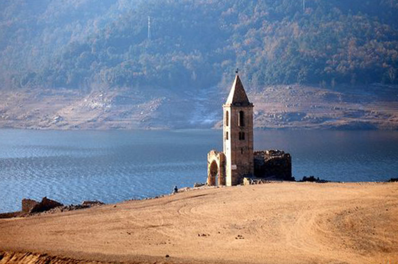
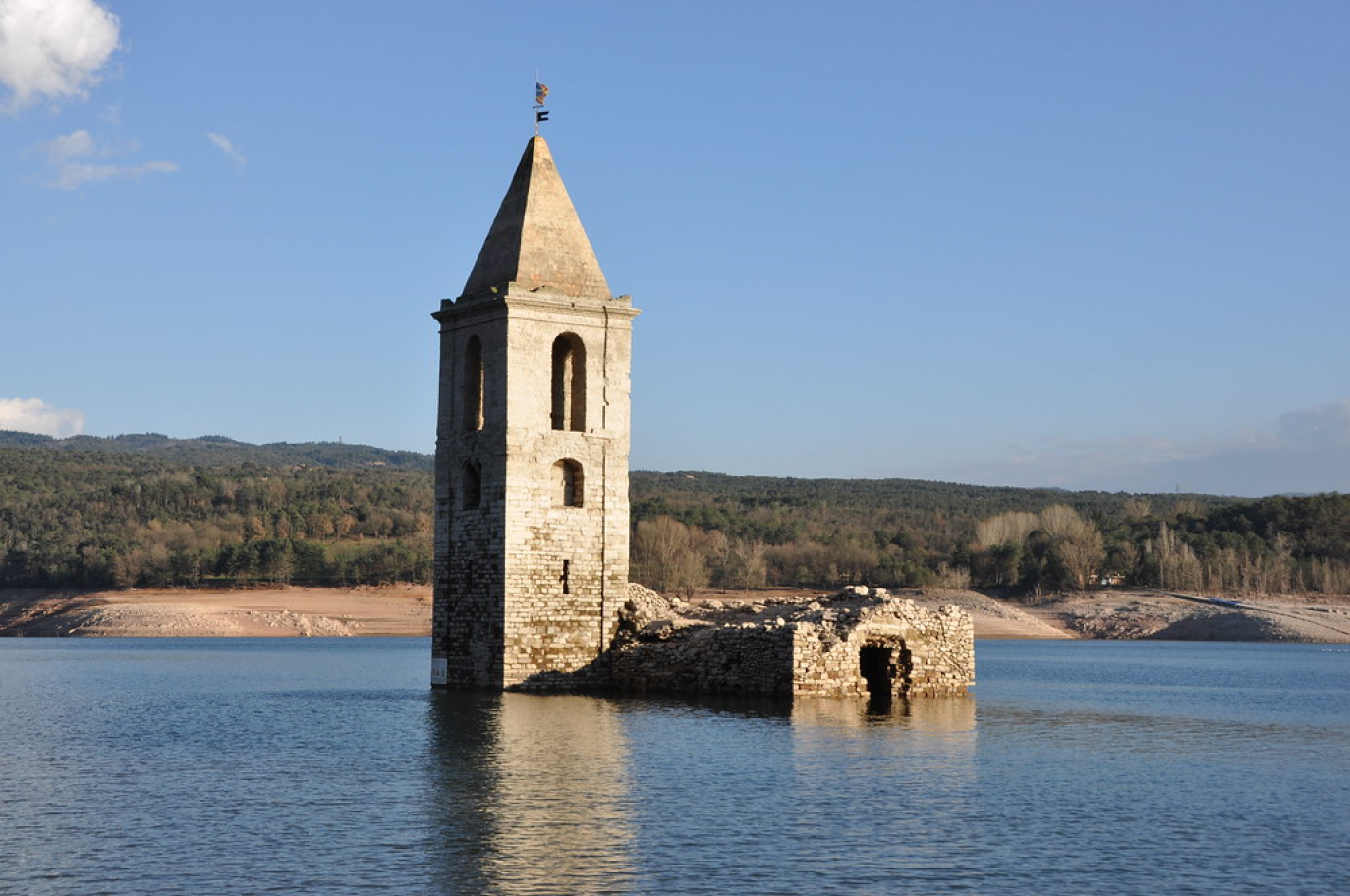
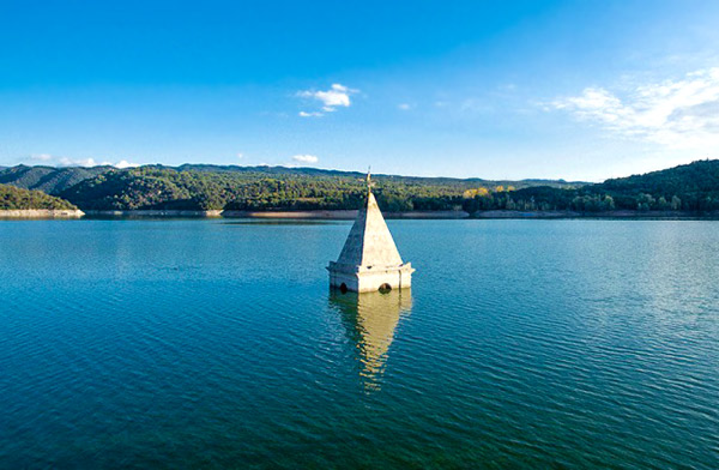
Typically, reservoirs hover around 70% capacity, but as of April, they’re dwindling below 17%.
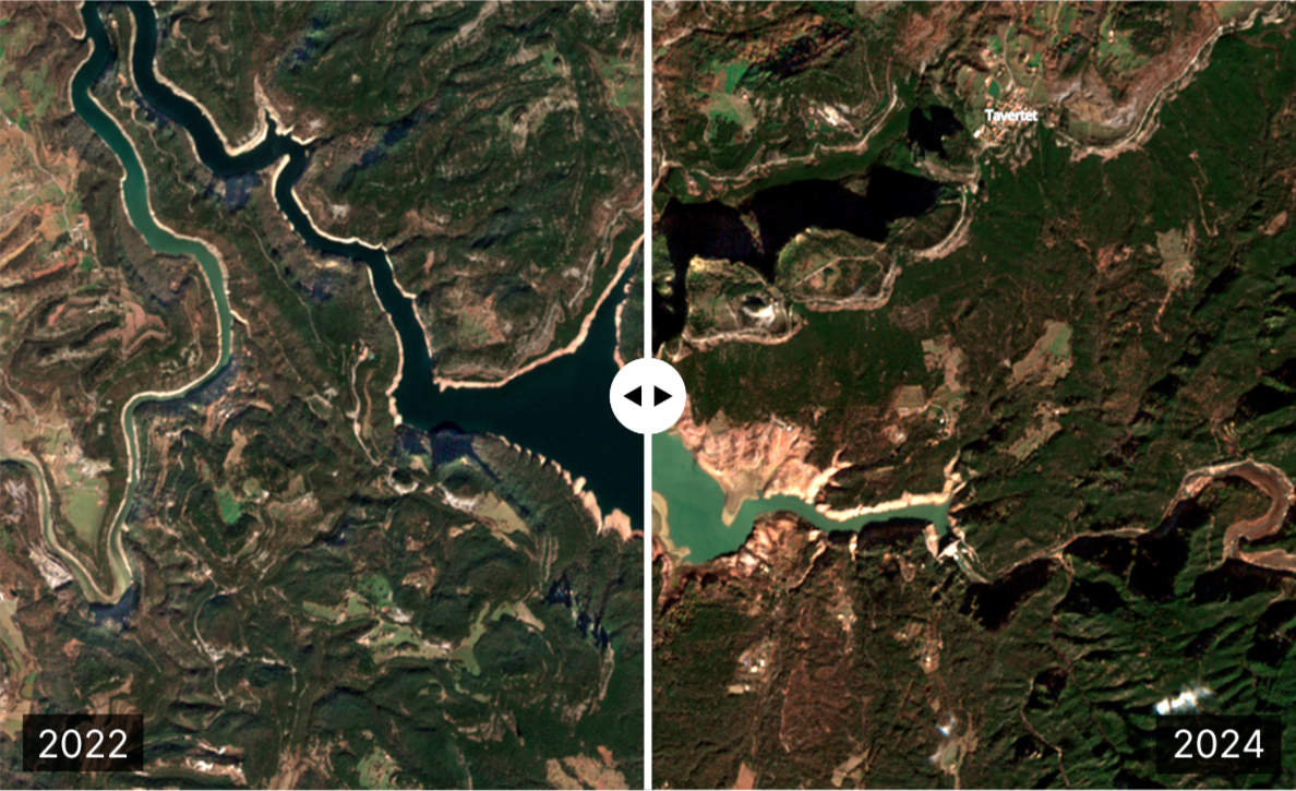
The stark contrast in the satellite image comparison of the Sau reservoir between February 2022 and February 2024 (Sentinel-2) vividly illustrates the severity of the situation.
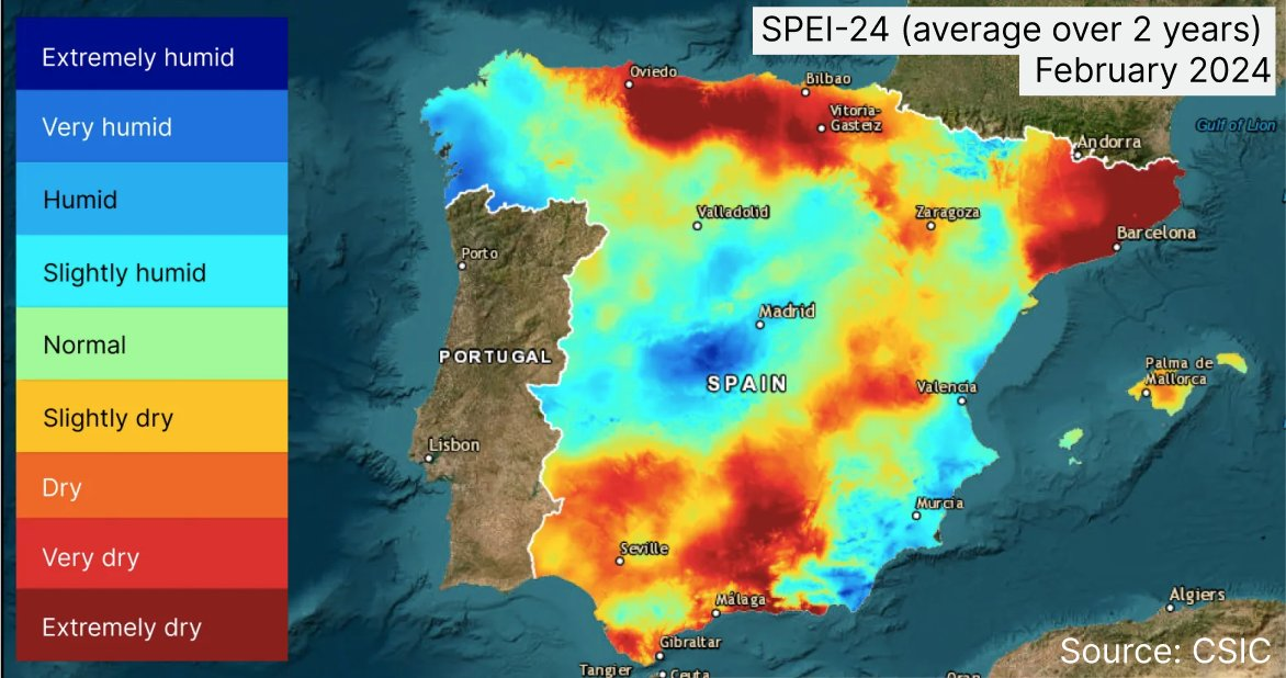
"Rainfall is not the whole story when it comes to measuring drought. [...]
The SPEI (Standard Precipitation and Evaporation) Index provides a more accurate picture of real world drought conditions in a given time period."
SPEI-24 shows extremely dry conditions in Catalonia
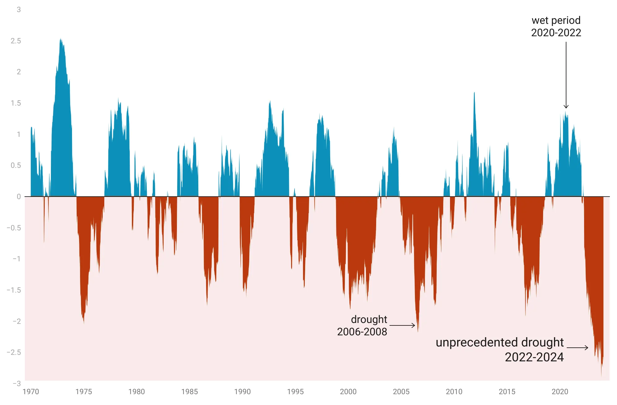
Drought is not a new thing.
Over the last 60 years, Catalonia has seen a drought every decade.
But the severity of the current drought is unprecedented, with the lowest SPEI ever recorded in the region...
Source: @lobeliaearth adapted from CISC data
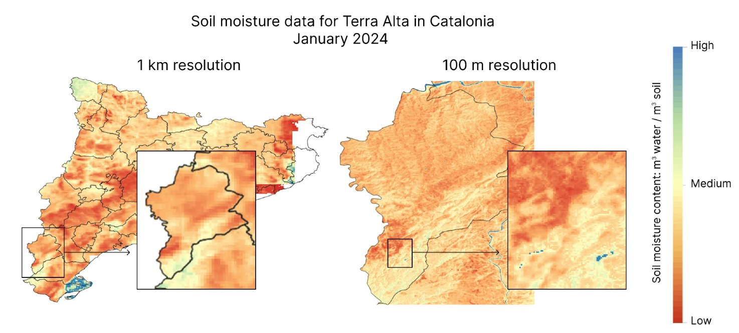
How can we monitor drought impacts?
Impacts show up first as low #SoilMoisture (SM) & quickly affect plant life, soil microbes, & eventually the wider ecosystem.
Using satellite data and in situ measurements, we generate high-resolution SM maps with a precision down to 100m.
Source: @lobeliaearth
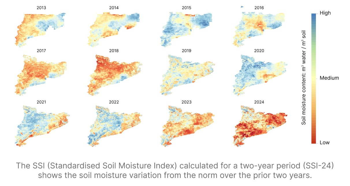
Looking at satellite #SoilMoisture trends over a decade, we can see how different areas recovered, or were unable to recover, during long periods of #drought.
Source: @lobeliaearth
What does the future hold?
Projections show that the climate by mid century will bring more severe droughts (SPEI approaching -2.5, or extremely dry, every ten years) in Catalonia, what was historically a once in 50 years event, will happen approximately every decade.
Source: @lobeliaearth

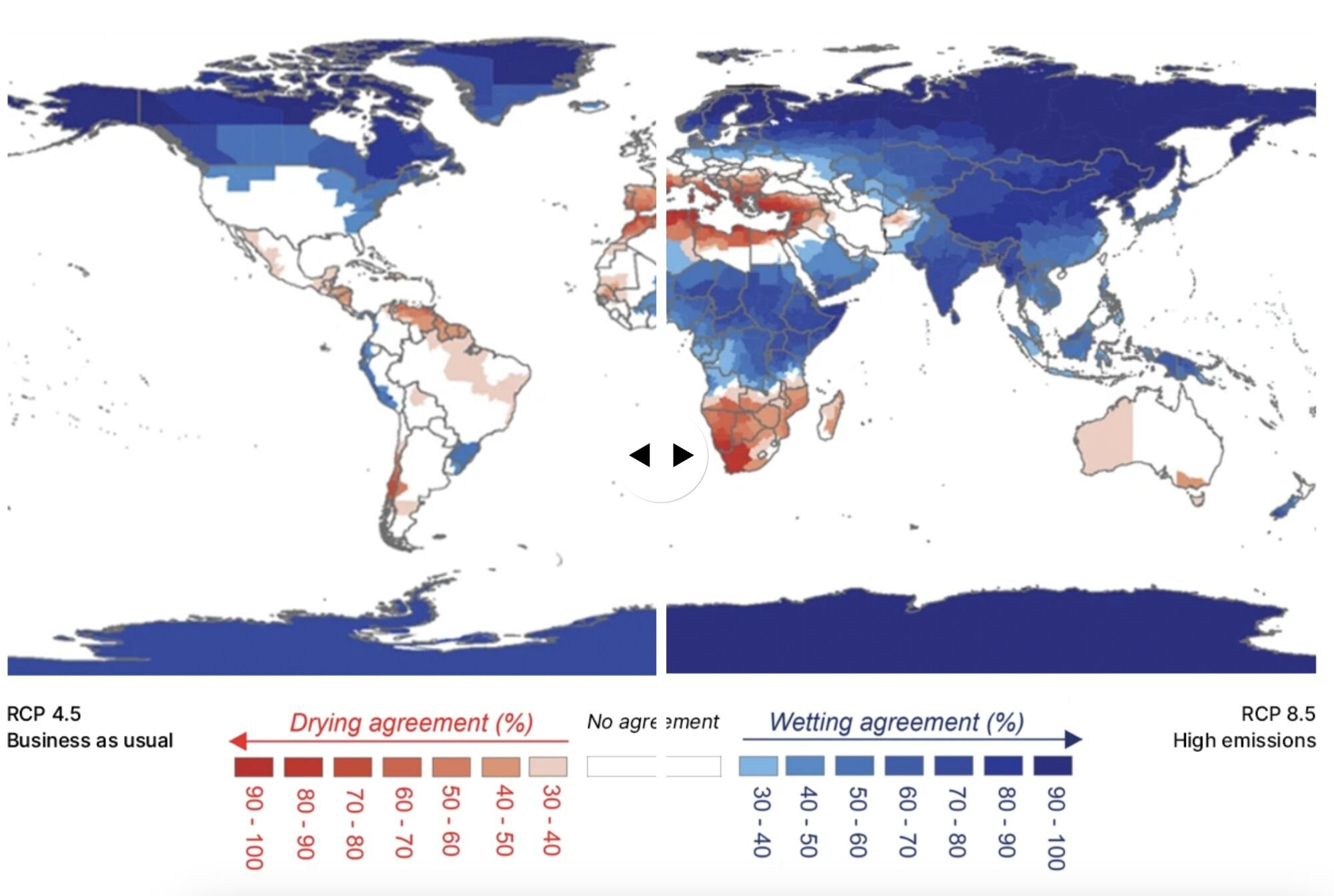
Changing precipitation patterns 
Shifts in global rainfall patterns driven by global warming are projected to impact large regions of the earth.
By 2100, under a moderate emissions scenario, 38% of the global population or 3 billion people could be impacted.
Under a high emissions scenario: 66% or 5 billion people will likely experience either more flooding or more drought
 Meeting the Challenge
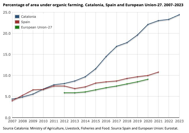
Catalonia is implementing sustainable initiatives, such as the Global Indicator of Climate Change Adaptation & the Catalan Strategy for Adapting to CC.
42 indicators make up the Global Indicator, among them, Organic agriculture has tripled since 2010.
Water savings and efficiency measures have reduced water consumption over the last two decades in Barcelona, making the city the third lowest in Europe in per capita consumption.
50% of water used in Barcelona is met by desalination and regeneration plants.


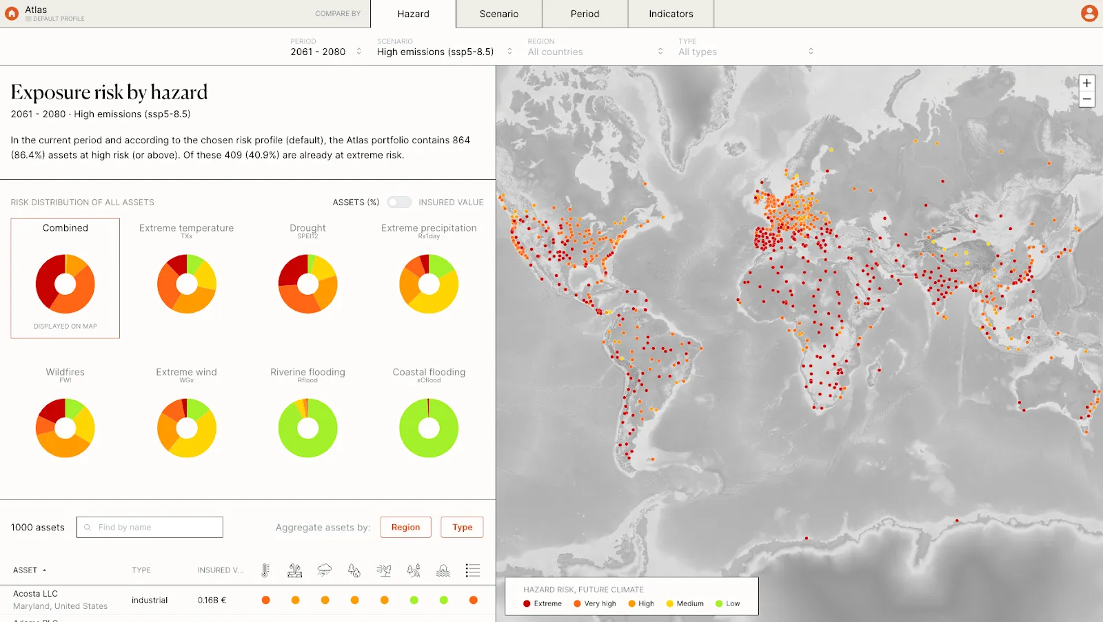
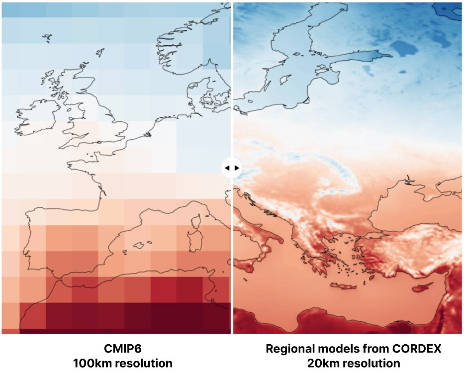
From global trends to local climate risk assessments: effective adaptation strategies benefit from precise climate data at a regional scale.
Geographic features like mountains and coastal areas impact local weather including droughts, floods, and extreme temperatures.
Our approach involves merging regional models (CORDEX) with in situ data to achieve a refined resolution of 20 km.
Visualising & quantifying exposure to severe weather events lowers risk for communities, investors, and businesses, and can catalyse the development of effective adaptation strategies.
Lobelia Climate shows future climate risks for a global portfolio of individual assets across the , assessing a combination of hazards including extreme temperature, extreme wind, drought, wildfires, flooding, or severe storm events.